From the 3D survey to the virtual reconstruction according to archaeological records
Alessandro VECCHIONE1 | Marco CALLIERI2
(1 Sapienza University of Rome | 2 ISTI-CNR, Rome Italy)
Keywords: Aqueduct , Rome , virtual reconstruction
Abstract:
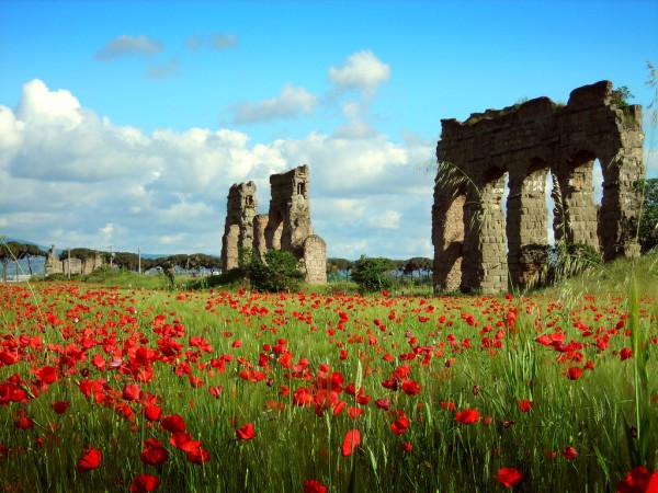
This paper presents a possible way to manage a virtual reconstruction of the Roman aqueduct Aqua Claudia in Rome, in particular, the section between Tor Fiscale and Porta Furba. The aqueduct is a peculiar monument, because it spans multiple scales: it has an architectural scale, as a building, but also a landscape scale, as a part of the local geography, and also a detail scale, considering each section as a single entity, with traces and carachteristics worth to be investigated.
Furthermore the modern urban illegal development and the fragmentary conservation status of the aqueduct due to a wide middle-age mining phase, resulted in the monument being split in several chunks, each one, now, an object on its own.
These considerations had a great influence on the methodology and on the data recording technique we had to choose: a classical total station survey was paired with a photogrammetric campaign, to cope with the different scales of the monument to be documented.
For the second step, that is the organization and visualization of the collected data, we chose to work with 3DHOP (3D Heritage Online Presenter), an open-source software package for the creation of interactive Web presentations of high-resolution 3D models. Using this tool, we have built a “3D hub” that, at different scales, can link together the 3D geoemtry, the data from the ground surveys and the classical archaeological records, providing a more immediate and structured access to the available information.
Thus, we have split the visualization into two differents layer: the first one, at a landscape scale, let us to have a complete view of the section; the second layer is focused on the single chunks of the monument, especially on their structure, to better understand the ancient building techniques and its evolution in time. The surveyed data will be also enriched with a modeling of the original shape of the aqueduct, and of its modifications.
Relevance conference / Relevance session:
The paper is focused in integrating archeological data in the framework of the ancient and modern cityscape, integrating different media using 3D as a spatial organization substrate.
Innovation:
We use the 3D data to provide a more natural access to the gathered information, exploiting the geometry space to spatially organize the data, and following the multi-scale nature of the monument.
References:
- Ministero per i beni culturali\Istituto Nazionale per la Grafica – I.W.S.A. – A.C.E.A., “Il trionfo dell’acqua. Immagini e forme dell’acqua nelle arti figurative”. Ernesto Paleani Editore, Roma, 1986
- 3DHOP: 3D Heritage Online Presenter
Marco Potenziani, , Marco Callieri, Matteo Dellepiane, Massimiliano Corsini, Federico Ponchio, Roberto Scopigno, Visual Computing Lab, ISTI CNR, Pisa, Italy
Figure: